


.jpg)
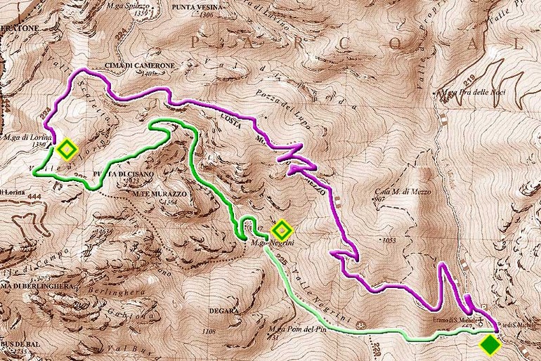
From Campione to Pieve di Tremosine
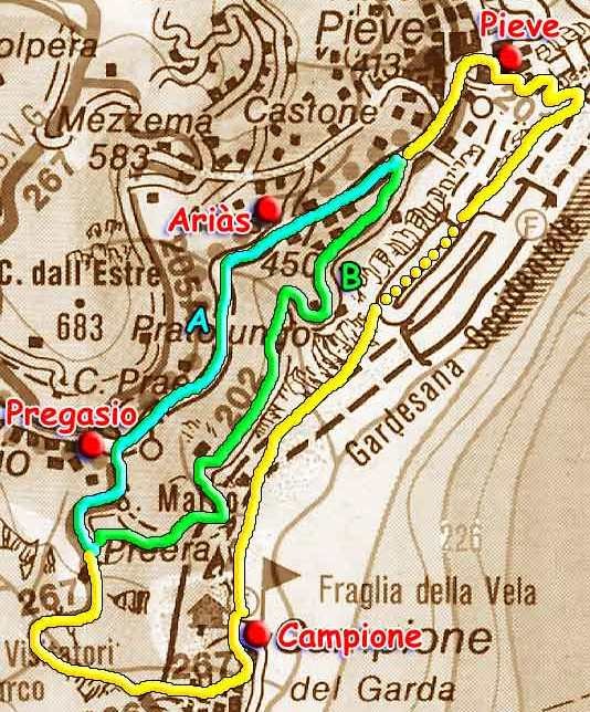
Info Departure: Campione (m. 74 s.l.)
Arrival: Campione (m. 74 s.l.)
Total difference in height (round trip): 680 m.
Time: 3 hours
Difficulty: ( E ) Excursionist. Itineraries on trails or tracks, usually marked and sometimes long, with exposed but well-protected sections. These routes require some experience and training.
Period: all year
Map: Kompass n. 071, 101 e 690
Access: from State road S.S. 45 bis for Campione, between Limone and Gargnano; parking.
More...
To Monte Castello of Gaino
.jpg)
Departure: Fornìco (207 m.)
Arrival: Fornìco (207 m.)
Total difference in height (round trip): 1.346 m.
Time: 4 hours
Difficulty: E = Excursionist. Itineraries on trails or tracks, usually marked and sometimes long, with exposed but well-protected sections. These routes require some experience and training.
Period: all year
Map: Kompass n. 102
Access: from Bogliaco, a district of Gargnano, on State road S.S. 45 bis, by car to Fornìco; parking.
More...
Limone sul Garda : From Limone to the Bonaventura Segala Chalet
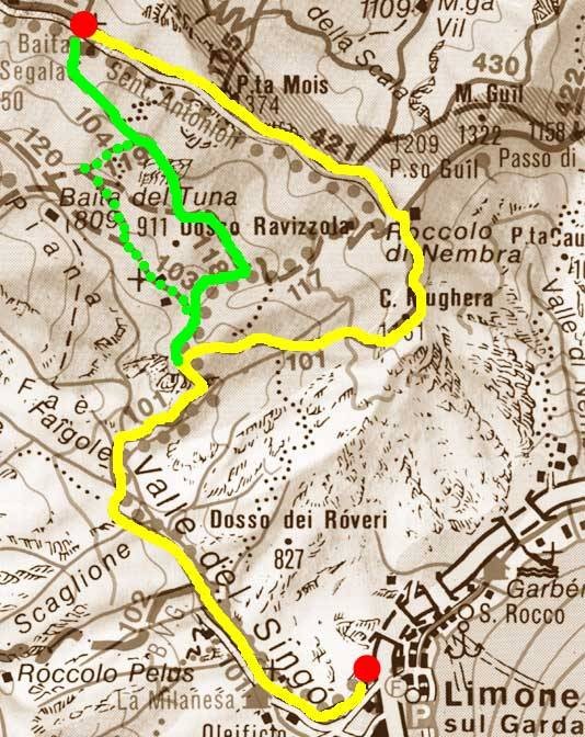
Departure: Limone sul Garda (65 m.)
Arrival: Limone sul Garda (65 m.)
Total difference in height (round trip): 2,300 m.
Time: 6 hours
Difficulty: ( E ) Excursionist. Itineraries on trails or tracks, usually marked and sometimes long, with exposed but well-protected sections. These routes require some experience and training.
Period: all year
Map: Kompass n. 071, 096, 101, 102 e 690
Access: along State road S.S. n. 45 bis, from Riva del Garda or from Gargnano, to Limone sul Garda; parking.
More...
From Gàrdola to Passo dEre
.jpg)
Departure: Gàrdola (m. 567)
Arrival: Gàrdola (m. 567)
Total difference in height (round trip): 1,140 m.
Time: 5 hours
Difficulty: ( E ) Excursionist. Itineraries on trails or tracks, usually marked and sometimes long, with exposed but well-protected sections. These routes require some experience and training.
Period: all year
Map: Kompass K102
Access: from State road S.S. 45 bis to Tignale along the province road n. 38; Gàrdola; parking.
More...
From Campione to Prabione
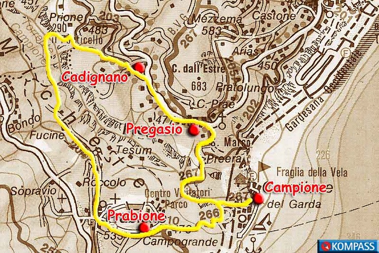
Departure: Campione (74 m)
Arrival: Campione (74 m)
Total difference in height (round trip): 940 m.
Time: 4 hr.
Difficulty: ( E ) = Excursionist. Itineraries on trails or tracks, usually marked and sometimes long, with exposed but well-protected sections. These routes require some experience and training.
Period: all year
Map: Kompass n. 071, 101 e 690
Access: from State road S.S. 45 bis to Campione, between Limone and Gargnano; parking.
More...
Gargnano - From Sasso to the Saint Valentine hermitage
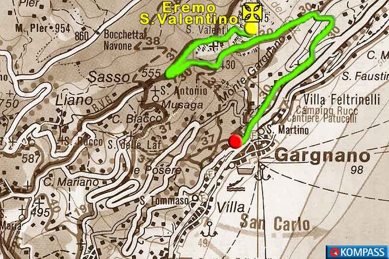
Departure: Sasso (555 m.)
Arrival: Sasso (555 m.
Total difference in height (round trip): 340 m.
Time: 2 hours
Difficulty: T = Tourist. Includes itineraries on roads, mule trails and easy, well-marked trails that have no uncertainties, difficulty or problems with orientation. These routes are also suitable for beginners and first-time mountain hikers.
Period: all year
Map: Kompass n. 071, 101 e 102
Access: from the state road S.S. 45 bis, to Gargnano, take the road for Navazzo and Valvestino; at the intersection, after 7 km, bear right for Sasso; parking.
More...
The Sentiero delle Tracce Tracks trail in Tremosine
"Sentiero delle tracce", the Tracks Trail, is a nature trail that winds through the Gardesana Occidentale regional forest, in the community of Tremosine, which is a striking, wild setting along the eastern side of Mount Caplone.
Besides its breathtaking panoramas, the trail offers visitors a chance to observe the tracks left by the local fauna.
More...
Besides its breathtaking panoramas, the trail offers visitors a chance to observe the tracks left by the local fauna.
More...
Cookies help us to deliver our services. By using these services, you agree to the use of cookies on the Website. More info


© 2015 VisitGarda All Rights Reserved c.f. e p.i. 02081030229
 Powered by iSite
iVision Group